The Glimmering Glory of Glymur: A Hike to Iceland's Second-Highest Waterfall
Glymur is only an hour and a half away from Reykjavik city and the hike takes less than four hours.
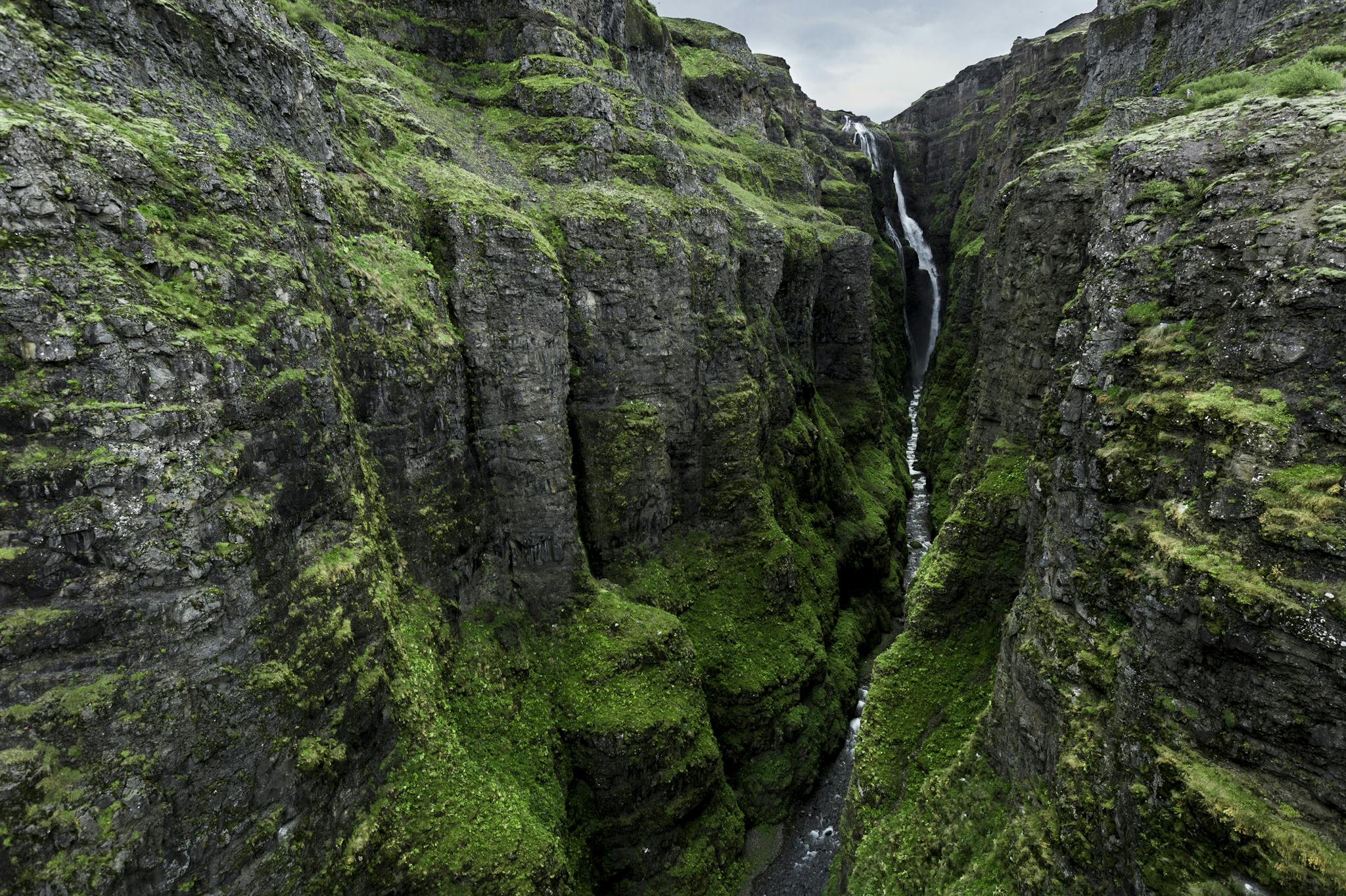
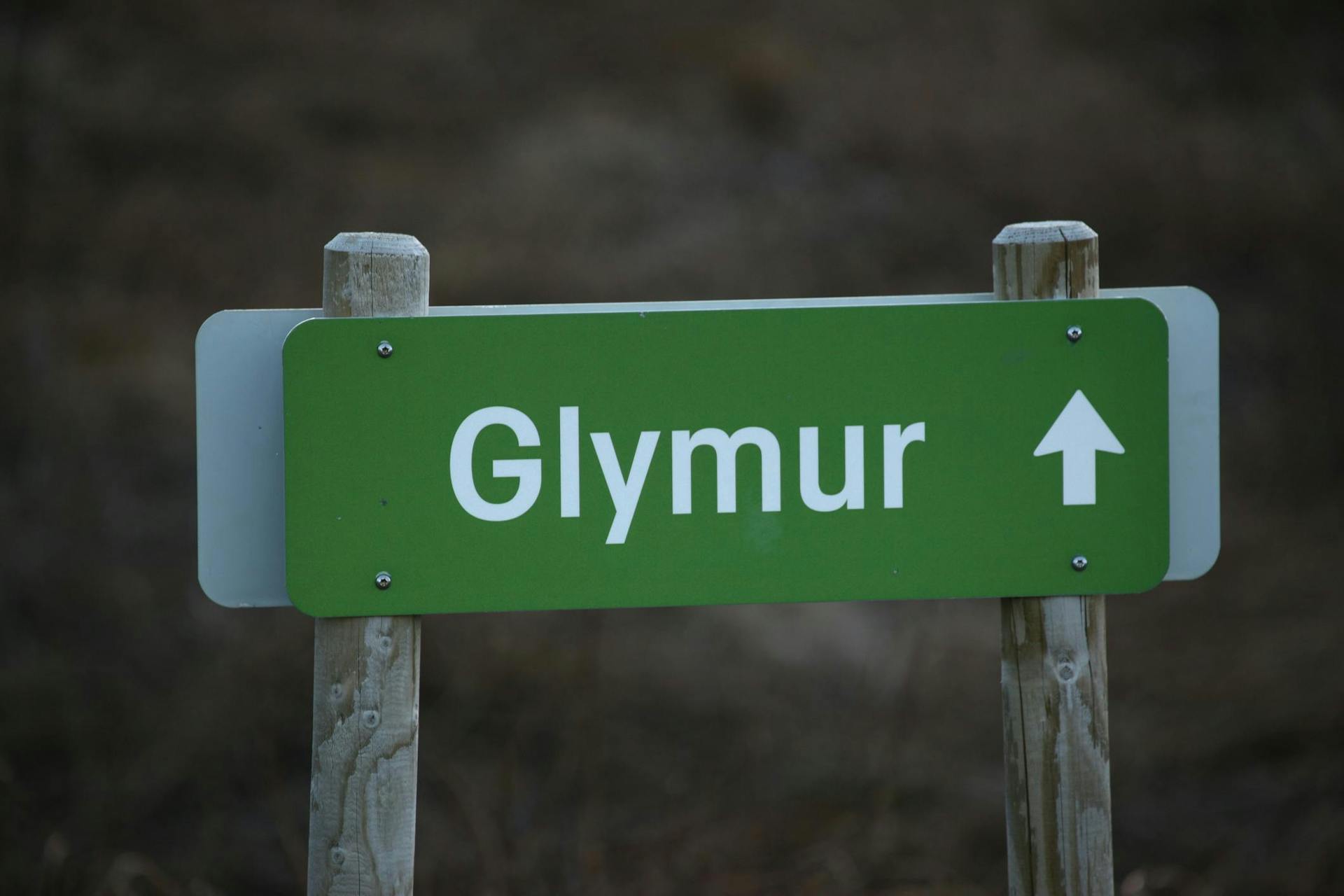
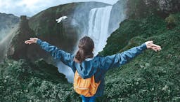
Rapids, caves, and cliffs lead along the trail to Glymur, a majestic waterfall enthroned in the ravine that its rushing waters cut into the mountains. At 197 metres, Glymur is the second-highest waterfall in Iceland — but far more accessible than the recently-discovered Mosárfoss. Located just north of Reykjavík, this trail makes for a vigorous and pleasantly challenging day hike in spring, best attempted with friends who have a sense of adventure.
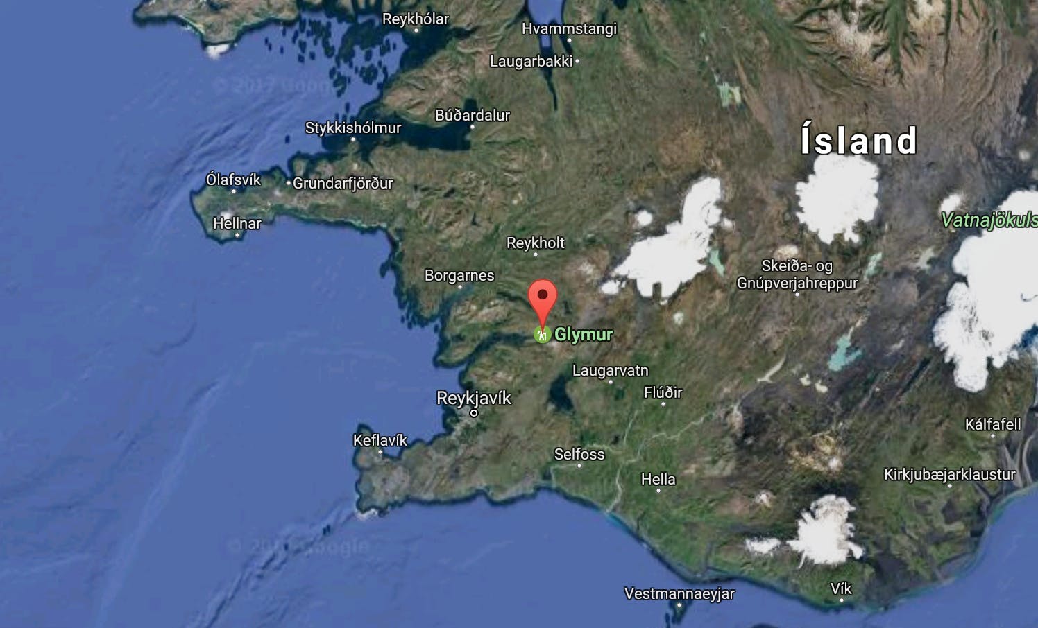
It only takes an hour and a half to drive from Reykjavik to Glymur.
Take a good look at the map in the parking lot when you arrive, as the routes are marked along the way, but it’s best to know it in case you lose your way. The first part is an easy jaunt through scrubby bushes and gnarled trees to Botnsá, the river, as it flows out the mouth of the canyon.


Scramble through the caves that connect the trail to the riverbank, pausing a moment to listen to the rapids, which echo like thunder when the river is high. The falls themselves are audible long before they are visible: the rumbling noise of water smashing against rock is what inspired their name. It’s easy to believe that such a force could carve out the canyon leading up to the waterfall, but even so, coming face-to-face with the reality of it is breathtaking.
 Wonderguide/iStockphotos
 Wonderguide/iStockphotos
The hike to Glymur has its perils, the first of which is the lower river crossing. In summer, a log helps hikers avoid the rushing waters, but in the off-season this is absent. There is a strong cable stretched across the water, but the current is fast and strong, and the river is deep. Some people choose to cross it sloth-style, clinging with hands and feet to the wire, while others opt to wade across, using the cable for balance and anchor.
For the small in stature, it can be a difficult crossing, and trying it alone is not recommended. Don’t worry — this is an optional part of the Glymur trail, and it’s possible to go up and come back by the left side, which requires no wading whatsoever. But if you’re prepared for it, you can make a safe crossing and begin your adventure by getting soaking wet. Bring a towel!
The trail then climbs steeply, and leads along increasingly dizzying clifftops, which can be difficult for those without a good head for heights. The views are worth the fear, but be prepared for the sight of a sheer hundred-metre drop into churning rapids. Pick the path that looks safest to you, as the best-trodden trail often winds along the edge of the gorge. This is only one option, and as long as you keep parallel and close to it, you can pick out a way across the rock and brush. Watch out for loose rocks and slippery mud, and take it at your own pace.
 Wonderguide/iStockphotos
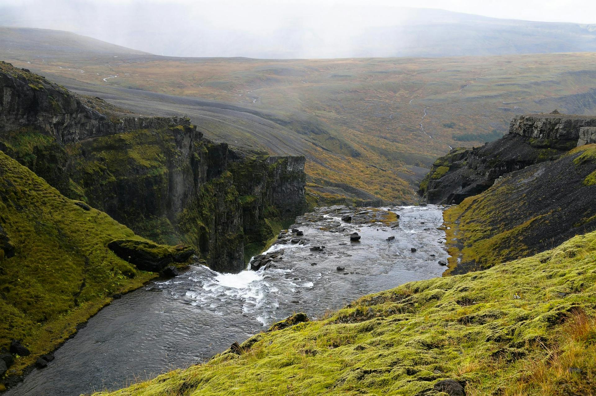
As the path leads higher, the ground becomes more open, bringing the vastness of the plateau up against the sharp lines of the ravine. Birdlife is abundant: the fulmars nesting in the cliffs provide a sense of scale as they wheel through the ravine, tiny white specks against the dark sheen of stone.
Harlequin ducks can occasionally be spotted, distinctive with their ruddy wings and neatly-painted markings. Listen for curlews, sometimes found in the uplands. The plants of the area are mainly a variety of willows and other shrubs, mosses, and in spring, flowers such as purple saxifrage. Sometimes the mist from the waterfall will catch on the low-lying leaves of the lupine, a quietly enchanting sight in the midst of Glymur’s grandeur.
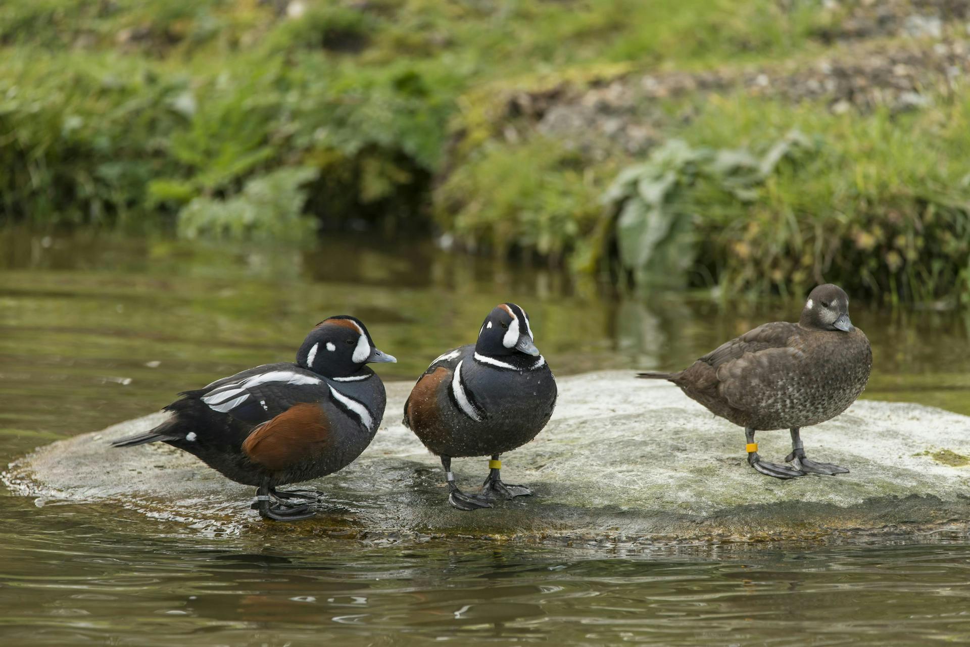 Harlequin ducks. Wonderguide/iStockphotos
When you reach the top of the falls, there’s another river crossing, though the good news is that this one is much shallower and can be achieved without the help of a wire (or taller friends!). The bad news is that it’s considerably wider, and the water is frigid, especially early in the season when it consists of newly melted ice. Sometimes it is impassible, due to blocks of ice floating downstream, so assess the situation before you make the crossing. Retracing your steps and re-crossing the river at the bottom is always an option.
With two river crossings, one of which is quite deep, warmth is an important thing to keep in mind on this hike. Bring an extra pair of socks, an extra base layer, and sturdy mittens or gloves; while the hike can be hot work, you’ll be glad to put on something warm and dry especially after the second crossing. A thermos of tea is also reviving and rewarding when you’ve been up to your knees in cold water.
Descending on the left side of the falls can be a gentler journey than the way up, keeping atop the sloping fells rather than alongside the sheer cliffs. The landscape is of tumbled rock and moss, with occasional gullies opening onto the ravine, affording sudden but spectacular views into its depths.
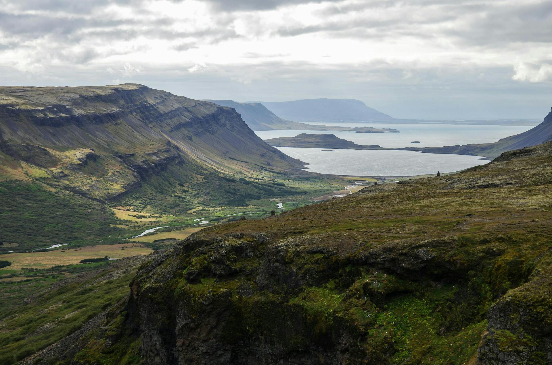 The breathtaking view over Fjord Hvalfjörður. Wonderguide/iStockphotos
Looking towards the horizon, you can see the length of Hvalfjörður, and spot Geirsholmi, the island on which, according to Harðar saga, a band of outlaws survived for several years. On a clear day, the water looks temptingly blue. Both the fjord and the lake that feeds Glymur, Hvalvatn, are named for the same folktale, in which a man is transformed into an evil whale, and is lured to his death in the lake after having climbed up the waterfall.
Practical info
The entire hike takes approximately 3-4 hours, and is roughly 5 km (3 miles) in length. The elevation difference from the parking lot to the top of the falls is approximately 350 metres (1150 ft). A sign at the parking lot tells hikers whether the log is up at the first river crossing, though the cable is a permanent fixture.
To get to the trailhead:
Drive north on Route 1 from Reykjavík, but turn right before the Hvalfjörður tunnel onto Route 47. At the end of the fjord, turn right at the sign for Glymur, and follow the dirt road for around ten minutes. It’s about an hour’s drive from Reykjavík.
Bring:
Extra socks, gloves, and hat; sturdy hiking boots; a dry bag; cold water; hot tea; snacks or a light lunch; a towel.
People also like this
Sharing is caring!