
Westfjords of Iceland: 4 Day "Hot Pools and Hiking" Itinerary
This itinerary is based on a road trip I went on around the Westfjords peninsula in Iceland. I decided to focus on natural geothermal pools and hiking during the trip.
Updated on December 23rd 2018.
The remote Westfjords of Iceland are often overlooked by tourists. The peninsula isn’t a part of the traditional Ring Road road trip and it is too far away from the city for a day tour.
Large areas of the Westfjords aren’t populated at all. You can drive for hours without seeing a single home, except maybe an occasional farm.
This itinerary is based on a road trip I went on just a few weeks ago. I only explored the south coast of the Westfjords, which is a great 4-day itinerary if your starting point is Reykjavik. My mission during the trip was to find as many natural hot pools as possible and hike a little bit as well. I knew there were some relatively unknown pools in the area and also on the way from Reykjavik to the Westfjords peninsula but I hadn't been to any of them yet. This mission went pretty well so I thought I might share my experience.
The itinerary is pretty detailed and I will suggest all kinds of activities and attractions that you can totally skip if you feel like the schedule is too tight.
I decided to include both campsites and other accommodation (hotels and hostels) so I think it’s safe to say that it is both suitable for those who like camping and those who prefer hotels.
Some of you might be wondering if it’s necessary to have your own car or whether a similar route can be done by public transport. I highly recommend that you rent a car, you won’t be able to go far if you rely solely on public transport in this remote area of Iceland. You could try to hitchhike but I can’t promise you that it will be very efficient since there isn’t much traffic in the Westfjords, compared to the Ring Road for example.
Day 1: Reykjavik to Snorrastadir
Departure time: Around 9 am.
First stop: Borgarnes
Your first destination of the day is the town of Borgarnes. Your mission in Borgarnes is to stock up on food and other necessities. Go to Bónus supermarket for cheap food and do some grocery shopping for the whole trip. You won’t be traveling to large towns that have decent supermarkets so I advice you to plan ahead! If you want to get some alcohol, go to the Vínbúðin in Borgarnes (closed on Sundays).
If you are already craving some lunch, go to a bakery called Geirabakarí. If you want to do something recreational while you’re in Borgarnes, go visit the Settlement Center.
Second stop: Landbrotalaug Geothermal Pool
After the pit stop in Borgarnes, take Road 54 towards Stykkishólmur (do not take the Ring Road!). Now you are actually heading to the first geothermal pool of the trip, called Landbrotalaug. After you have driven approximately 25 mi (40 km), make a turn by the farm Skjálg. Then you continue about 0.6 miles on a faint gravel track until the trail isn’t visible anymore.
Park your car and walk towards the water you’ll see straight ahead of you. Circle the pond, then you’ll see Landbrotalaug on your right. After lingering in the pool you can either continue your journey or check out another thermal pool south of Landbrotalaug.
I haven’t been there but according the book Thermal Pools in Iceland, you can get to that pool by taking a left from the parking space towards the pond. You’ll have to wade across it and then you come to a borehole where a small lagoon has formed. This is apparently a very shallow thermal pool but it’s possible to lie flat if you want to get immersed.
If you decide to picnic by the pool, please do not leave any rubbish behind!
Third stop: Gudrunarlaug Hot Pool in Laugar
Take Road 55 and continue driving to the north. Turn right on Road 54 and drive past the town of Budardalur. You are now heading towards Gudrunarlaug Hot Pool in Laugar, where you’ll spend the night.
The pool is located in Laugar, Sælingsdalur. Sælingsdalur is in the Dalir region in northwest Iceland. Turn to the left on Sælingsdalsvegur about 20 minutes after you pass the town of Búðardalur.
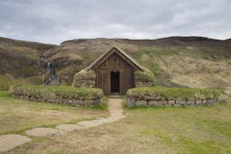
Stop your car in front of the Hótel Edda in Laugar. Then walk up a small hill, just across the hotel. You will probably spot the medieval-style changing room from the road.
After having soaked in the wonderful Gudrunarlaug, go hiking in the area if you are feeling active.
Where am I sleeping tonight?
Laugar is a great place to spend the night. The campsite is decent and the Hótel Edda is very nice. There are other options in the area if you don’t mind driving a little bit further north, such as Hótel Ljósaland and Reykhólar Hostel.
To find accommodation throughout rural Iceland, try Hey Iceland or Bungalo. There you can find more options than what’s listed on Booking.com or Airbnb.


Day 2: Laugar to Flokalundur
First stop: Gislahellir Cave
On this second day of your epic Westfjords road trip, you’ll bathe in more geothermal pools and go hiking.
Depart early and drive Road 60 towards the Westfjords Peninsula. Drive all the way to Flókalundur and enjoy the scenic view from the car. There is a cave on the way to Flókalundur, called Gíslahellir. I haven’t been there, but it’s actually pretty close to the road. If you are feeling adventurous you should definitely go ahead and explore the cave.
Second stop: Flokalundur
You will probably be starving when you arrive in Flokalundur so go ahead and have some lunch! There is a restaurant at the Hotel Flokalundur and a tiny grocery store if you fancy some food you don't already have with you.
Third stop: Mt. Lónfell
The next activity is hiking Mt. Lónfell. When Hrafna-Flóki, one of the first Norse men to set foot in Iceland, hiked the mountain on a cold winter day, he noticed that Breidafjordur Fjord was filled with pack ice. Flóki and his men decided to call the newly discovered island Iceland. I actually think this is a bit ironic because pack ice is not a common sight in Iceland. They must have arrived in Iceland on an extremely cold day!
Continue driving Road 60 towards the mountain. When a left turn on Road 63 is possible, park your car (do not turn to the left). Start hiking towards the mountain, it’s on your right hand side from the road.
You will have to hike 1.3 miles from the road until you reach the mountain. Although you won’t gain much elevation during the first stage of the hike, the ground is quite rocky and hard to pass.
Ascending the mountain is relatively easy, just try to avoid passing rock-bound surface. The view over Breidafjordur Fjord is spectacular, especially when the sky is clear.
Fourth stop: Hellulaug in Flokalundur
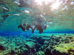
Drive back to Flokalundur after the hike and have dinner there. After dinner you’ll visit Hellulaug Geothermal Pool. The pool is located 0.2 mi. east of Flokalundur. Hellulaug is the perfect pool to visit in the evening and a great way to relax after a demanding day of traveling and hiking. More details about Hellulaug can be found here.


Where am I sleeping tonight?
You can book a room in Hotel Flokalundur here. If you prefer camping, there’s a good campsite just a stone throw away from the hotel.
Day 3: Latrabjarg and Raudisandur
First stop: Latrabjarg
Start your day by having breakfast in Flokalundur. Then head west towards Latrabjarg, the westernmost tip of the Westfjords.
Látrabjarg Cliff, located in the westernmost tip of the Westfjords, is characterised by steep awe-inspiring cliff walls crowded with seabirds. It is largely off the tourist-radar, perhaps due to its remote location.
At first I wasn’t quite sure if my tiny car would make it through the rough gravel roads on the way to Látrabjarg so I didn’t include it in my original itinerary. I decided to give it a try though: the weather was good and my car hadn’t given up on previous gravel roads during the trip.
Shortly after I arrived, I did some bird-spotting and then I went for a hike along the edge of the cliff. In short; the hike was fabulous and I did spot a puffin on the way. On the way back, a fox walked coolly past me – the first fox I’ve ever seen in Iceland.


There are numerous hiking trails in the Látrabjarg area but finding proper information about them online is impossible. The only info I found before I went was an inquiry on Lonely Planet from a guy that wanted to hike from Rauðisandur Beach to Látrabjarg. He got some vague answers about whether that trek was possible and I still don’t know it myself.
I, however, chose to hike from the Bjargtangar parking lot, which is the western tip of Látrabjarg, and eastwards to Heiðnakinn. Heiðnakinn is the highest peak of the cliff (1,447 ft) and it offers stunning views over Breiðafjörður Fjord.
The first part of the hike is also the most challenging bit. You ascend quickly but after that there are only gentle slopes. Be on the lookout for puffins and other interesting birds during the ascend because that’s where you get the best sights of the cliff walls.
Puffin season is from mid May to the end of August. I was in Látrabjarg in early June and I only saw one puffin.


The hike goes along the edge of the cliff, which is both very scary and pretty dangerous. Faint-hearted hikers can choose to hike farther away from the edge if they like, just a couple metres away from the actual trail.
Those who are more courageous might be tempted to go all the way to the edge of the cliff, trying to spot some birds. It’s easy to get carried away, listening to the birds and trying to catch a glimpse of the wavy ocean below, but I advice you to be careful – falling down the cliff means instant death.
The hike from Bjargtangar to Heiðnakinn is around 3.7 miles. The total distance of the hike, back and forth, is 7.4 miles. If want the hike to be shorter, you don’t have to go all the way to Heiðnakinn.
If you don’t have much time on your hands, you can easily just walk one mile to the east and then turn around and go back to the parking lot.
It takes at least seven hours to drive from Reykjavik to Látrabjarg. I really do not recommend going to Látrabjarg as a day tour out of Reykjavik though, it’s just too far away.
Shortly after Flókalundur, take Road 62 towards Látrabjarg. When you reach the head of the Patreksfjörður Fjord, get off Road 62 and onto a gravel road (Road 612). This road goes all the way to the parking lot at Bjargtangar. The good thing about this otherwise crappy road is that it's very scenic, like many roads in the Wesfjords. There's also an Aircraft Museum on the way and an abandoned ship— both are easily seen from the road.


Make sure you bring some food with you, there are no restaurants or shops in the area. If forget to stock up on food or gas, you can take a detour to the town of Patreksfjörður before heading towards the cliff.
Second stop: Rauðisandur
Rauðisandur, which translates directly to 'Red sand', is one of the few beaches in Iceland that aren't jet black. Its color is kind of orange, or red, in a certain kind of light. There is a very simple explanation for this unique color: the sand is made of remnants of pink scallop shells.
I featured Rauðisandur in an article called 6 Destinations in Iceland Where You Can Guarantee a Great Instagram Shot a few months ago and since then I have been dying to go there. I can tell you that Rauðisandur didn't disappoint me in any way—it was absolutely stunning!
The road leading to Rauðisandur isn't paved and it's actually pretty scary. It isn't dangerous if you drive carefully and travel when there is still daylight. Gravel roads are actually very common in the Westfjords as I've already told you, so you will have gotten used to them by now.


Where am I sleeping tonight?
You have a couple of options, depending on your budget and where exactly you want to stay. There are campsites at Melanes, Breidavik and Patreksfjordur. Melanes is closest to Raudisandur.
If you want to stay at a hotel, try Hnjotur Guesthouse (where you'll find the Aircraft Museum) or Hotel Latrabjarg. Patreksfjörður is the largest town of the southern part of the Westfjords so you might find some apartments there listed on AirBnB.
Day 4: Back to Reykjavik
First stop: Krosslaug
There wasn’t any geothermal pool on yesterday’s schedule but you will make up for that today. After breakfast, head back east on Road 62 until you reach the Birkimelur Settlement. The parking lot for the hot pool will be on your right hand side. Park there and walk towards the seashore. You will see two pools: One large concrete pool and one “natural” hot tub. Both of them are filled with warm water.
The water temperature is around 95°F so you should be able to linger in the pool for quite some time without getting too hot.


Second stop: Reykjavik
It’s time to go back to Reykjavik. It’s up to you whether you drive all the way back or take the ferry over Breidafjordur.
If you want to stop along the way, here are some suggestions:
- Glymur Waterfall Hike
- A Few kid-friendly destinations in West Iceland
- Into the Glacier Tour
- Reykholt
Photos: Wonderguide/Nina

People also like this
Sharing is caring!